
Mapping Air Pollution
Approximately 10 portable air pollution monitors will be available for attendees to borrow and take around campus for 15 minues. After this time, participants will return to our booth, where their data will be uploaded and projected onto a map showing the path they took and the pollutant levels they encountered on their way. All participants will contribute to the same map, allowing it to expand over the course of the day, ultimately leading to a "pollution map" of the campus and surrounding area.
Time
10:00 AM to 3:00 PM
Sponsor
Department of Civil and Environmental Engineering
Location


ACTIVITY MAP
View the campus map for the 2016 Open House
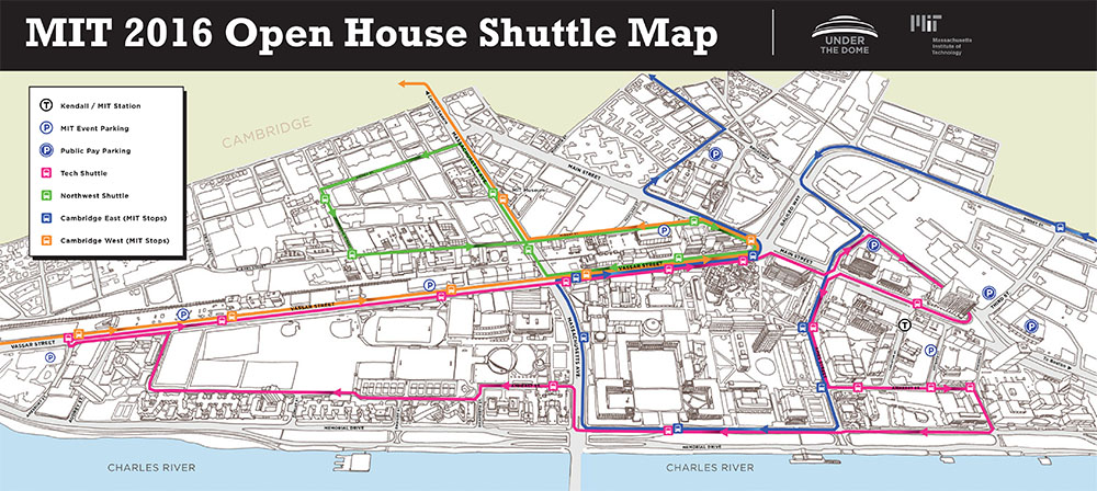
SHUTTLE MAP
View the shuttle map for the 2016 Open House